What happened
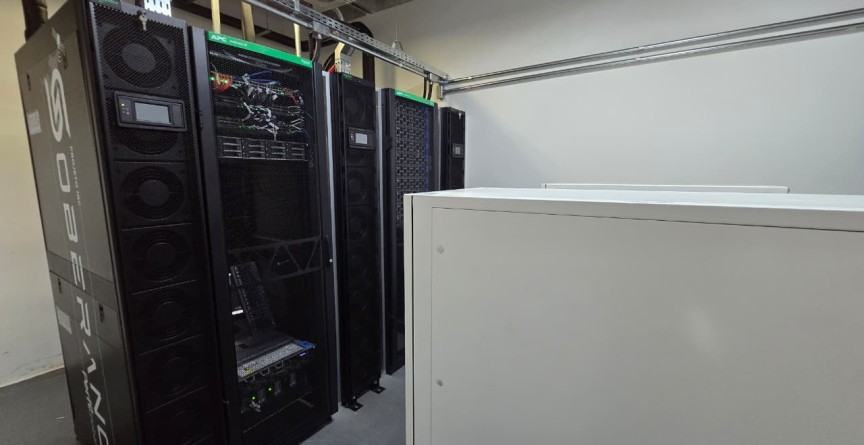
The university reports eight NVIDIA H200 accelerators, ten processing nodes and approximately 400 terabytes of storage in the Soberano system. Brazilian teams designed, installed and configured the infrastructure.
The Hyper-Cam Mini XLW records information across narrow spectral bands. GeoIDE aims to extract geographical information from satellite, radar, drone and hyperspectral data for environmental monitoring, disaster-response planning and other environmental and defence applications. Equipment will be shared among researchers and partner institutions.
Why it matters
The significance lies in connecting computing capacity to a defined public-sector problem. Faster processing alone does not establish better maps: accuracy, validation and reliable observations remain essential. Intended uses, including identifying deforestation or illegal mining, should not be confused with demonstrated operational results.
What to watch
Watch for evaluated mapping products, documented coverage gains and use by institutions responsible for land management and disaster planning. These outcomes will show whether the new equipment improves decisions beyond expanding available computing resources.
Sources & verification
Source links are not a count of independent confirmations.
01Report a correction
Help us get it right
Include the disputed statement and, if possible, a supporting source URL. Please do not send personal or sensitive information.